Earlier this year I released a major update to Pedometer++ which included a complete visual redesign of the app and brought workout tracking to the iPhone. This update represented a movement towards making Pedometer++ your best companion for outdoor walking adventures.
Today I’m releasing version 5.3 which completes this movement by rounding out some of the missing features from the v5 update. Specifically this update adds Route Planning and Offline Map Management.
I am a very avid hiker. It is my favorite activity and simply put it is my happy place. Because I’ve spent so many hours hiking I’ve developed a number of very strong opinions about what features are important for hiking and how best to build them. These features are built from the perspective of how I plan and track my hikes, developed with the benefit of countless adventures.
Route Planning
While you can continue to import GPX files from external sources into Pedometer++, I wanted to also create a method for planning the routes directly in Pedometer++.
I tend to use GPX files when I am new to an area and want to benefit from other people’s experience. There are numerous hiking trail resources online which publish the best routes in an area and are a valuable way to get familiar with a location.
After walking in an area for a while, however, I find that I typically want to start striking out on my own routes and find new places and hidden gems. There are a number of ways to build a route planner but my favorite method is to boil down a hike into a few key waypoints/viewpoints and then backwards plan a route between them. This is exactly how I’ve built the route planner for Pedometer++.
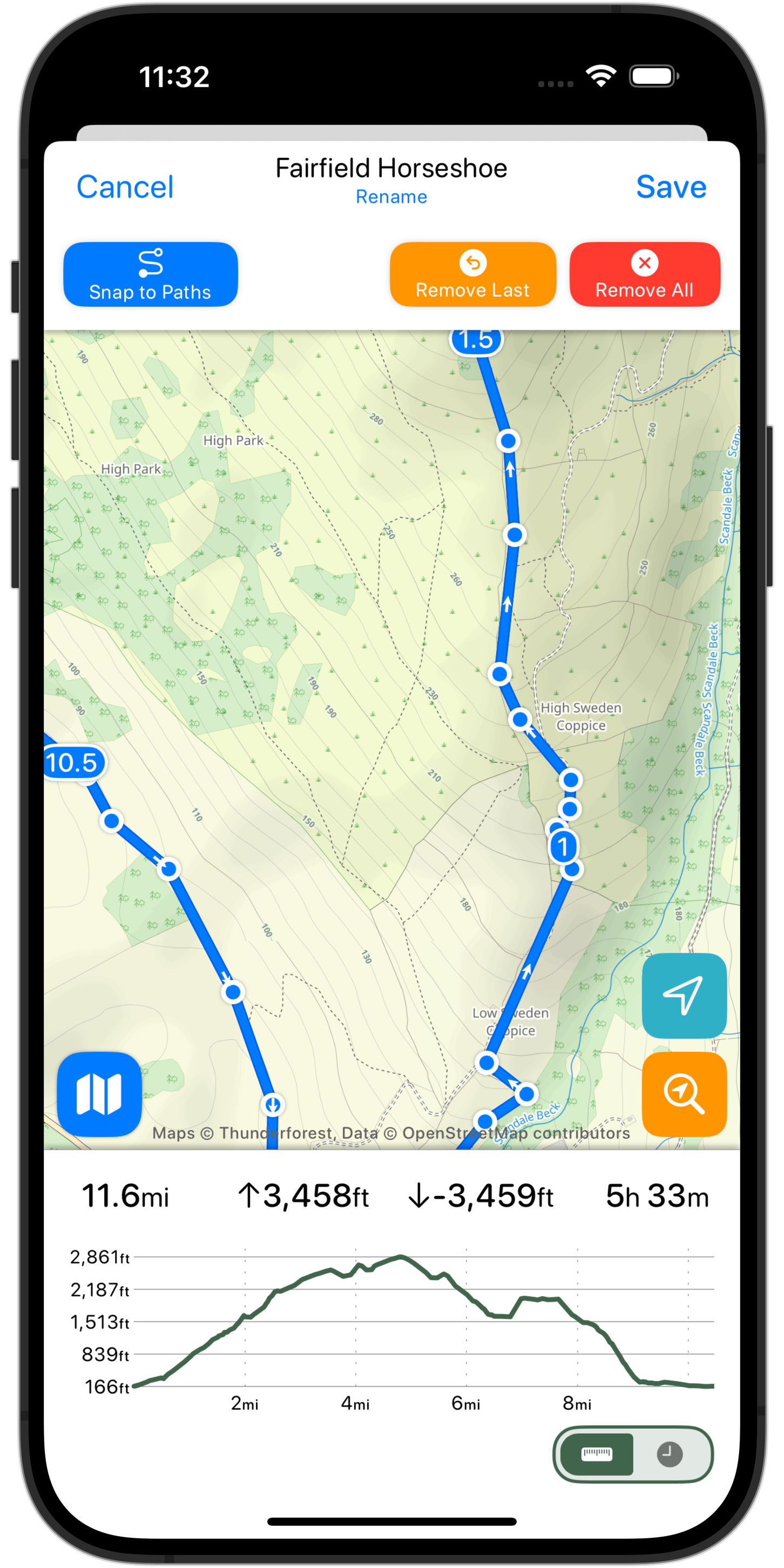
You simply tap on the locations you want to visit and it will use the Mapbox Directions API to find the shortest route between them. This typically serves as a great starting point for a route. While not necessarily the ‘best’ route, these automatic routes can make it super quick to plan a hike. I’ll often then tweak the automatic route to my tastes based on terrain, access or trail popularity.
Because this planning system is so straightforward and automated it was even possible to add it into the Apple Watch app as well.
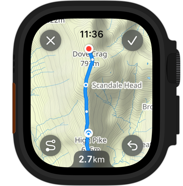
I’ve found this super helpful for when I’m actually out on a hike and want to quickly consider an alternative path. Rather than pulling out my iPhone and looking there, I can just tap “Plan a Route” on my wrist, tap a couple of waypoints and very quickly get a distance/route estimate for the possible detour. Then if I like the option I can simply save the new route and use it for the rest of hike, or until the detour is complete.
Offline Maps
Another important feature being added in this update is the ability to more widely download maps for offline use. Rather than just being able to download the map tiles for a particular route you can now download maps for a wide area before you head off on a hike.
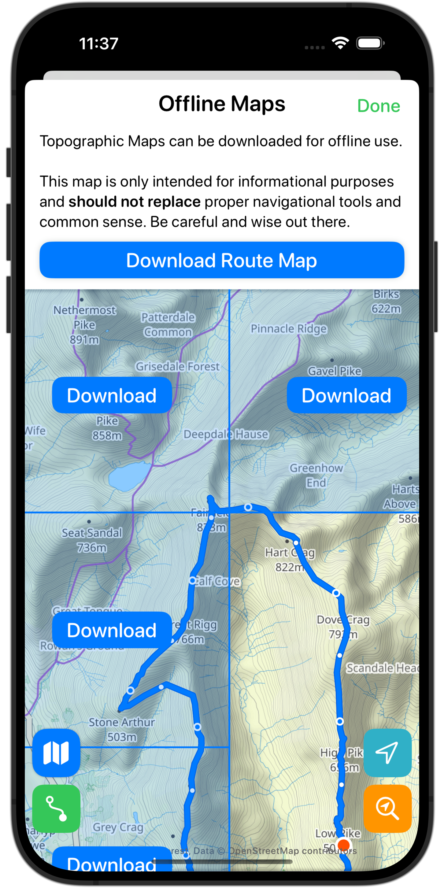
This works great for situations where you may be entering an area with limited connectivity. The maps on your iPhone are automatically available on your Apple Watch (as long as your iPhone is within range of your watch).
Ordnance Survey Maps
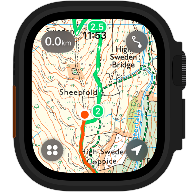
In the United Kingdom Ordnance Survey maps are the gold standard for outdoor navigation. They provide rich detail for walking routes and rights-of-way. Thankfully they are offered as an API which other apps can make use of and so I’ve been able to include them in this update.
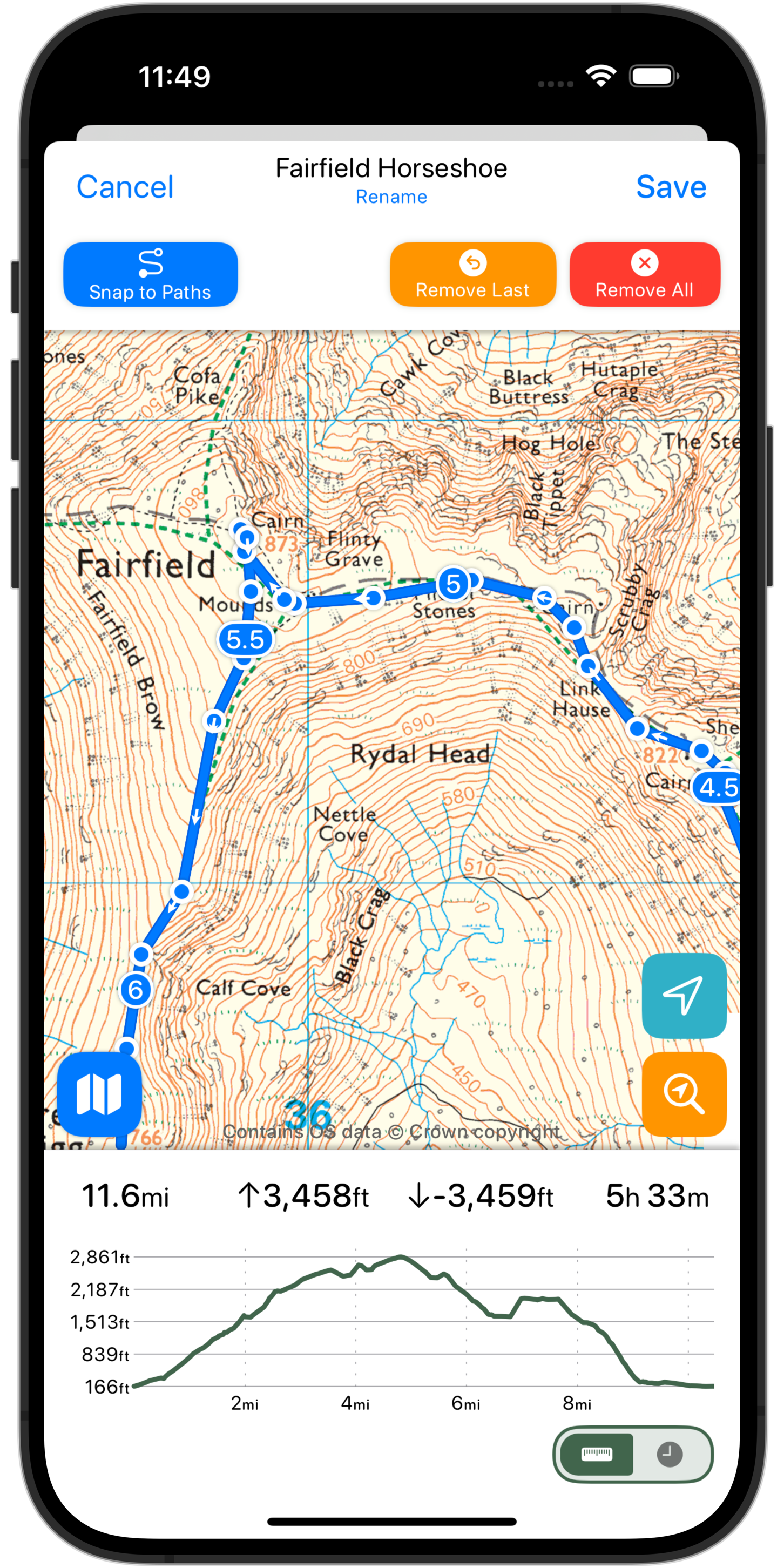
This is also available on your wrist during workouts on your Apple Watch.
Visual Refresh
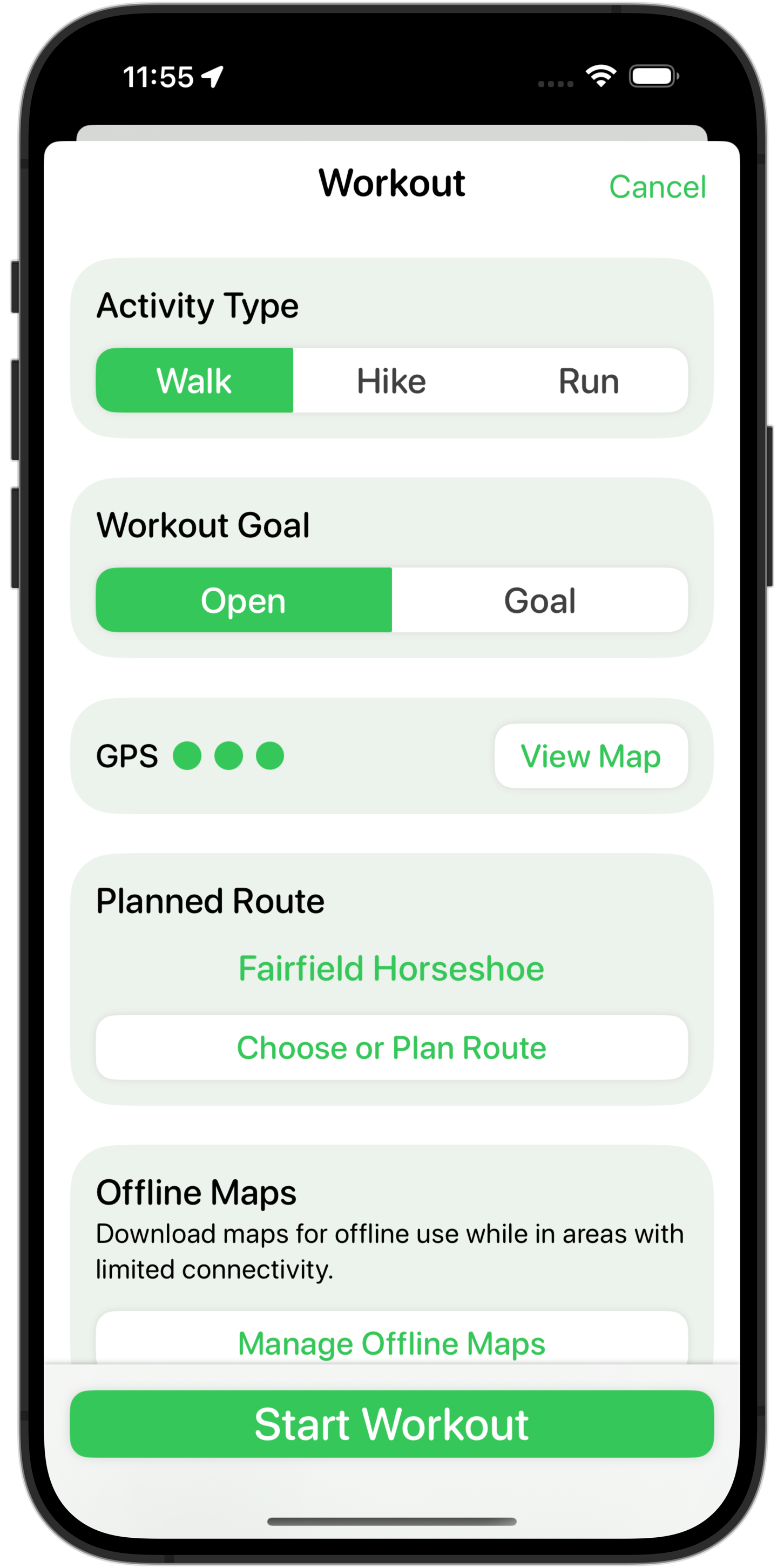
Lastly I’ve also done a lot of work to improve the visual design of both the iPhone and Apple Watch apps. The old design was feeling a bit “heavy” and cumbersome. I wanted to bring forward a design which felt more modern, clean and intuitive.
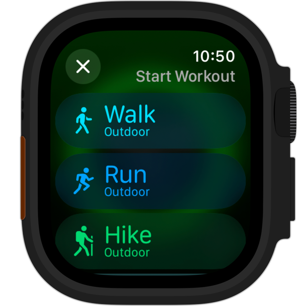
On the Apple Watch side of things I had done a partial update this September to bring the app more in line with the watchOS 10 design language. This update completes that work and fully embraces the new layering and visual aesthetic of watchOS.
I hope you enjoy this update, which is available on the App Store now.