Six months ago, I found myself really demotivated with my health and fitness. For a long time I’d been on a good run with working out and staying fit but I found that I was struggling to head to the gym and keep consistent with taking care of myself. This isn’t the first time this has happened to me but as I get older I am very aware that it is vital that I continue to fight against this tendency because the longer I let it go the harder it will be to come back. What I needed was a project.
I tend to work best when I a working towards something specific rather than just “general health”. As much as it would make sense to be working towards “a long and healthy life”, the reality is that just doesn’t get me out of bed. I needed something more tangible and short term. I need something which lets me tell myself that if I slack off now, I’ll pay for it later, and soon.
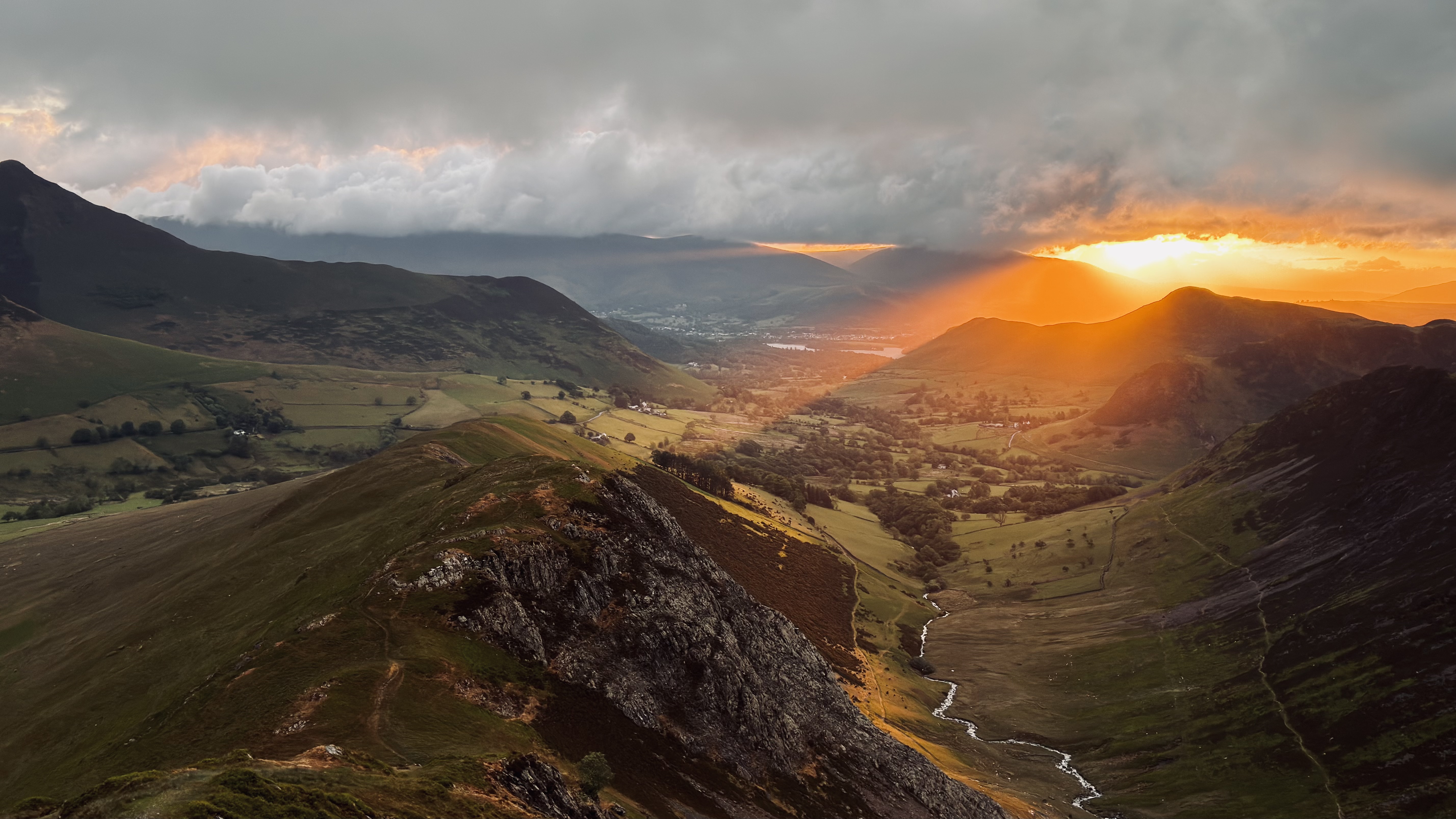
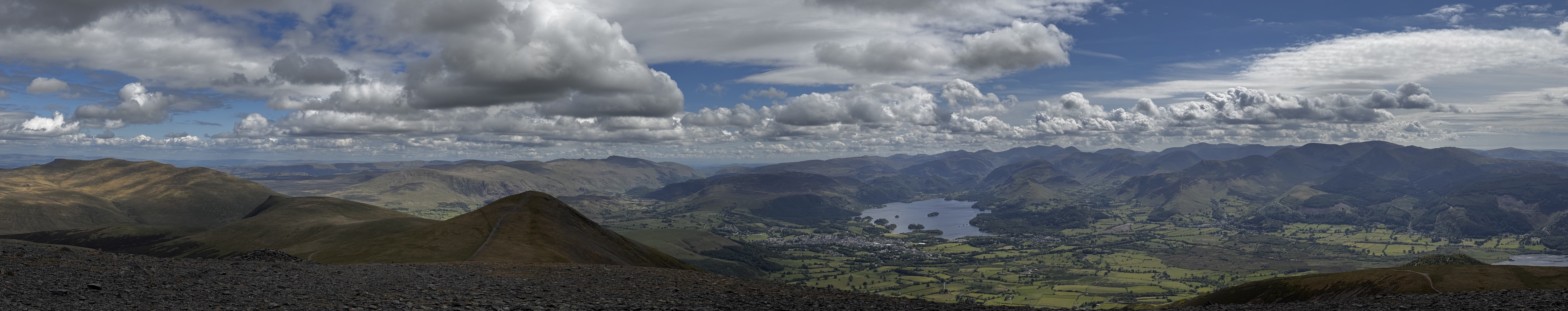
Last week I turned 42. Which ended up being the seed of the plan I came up with. My favorite place on earth is the English Lake District. Its combination of water, mountains and culture resonates with my soul at a fundamental level. I am never so happy as I am when I am out in the fells1. The relevant part of the Lake District’s mountain culture for me is the concept of the “Rounds”, long circular routes which circumnavigate the area.
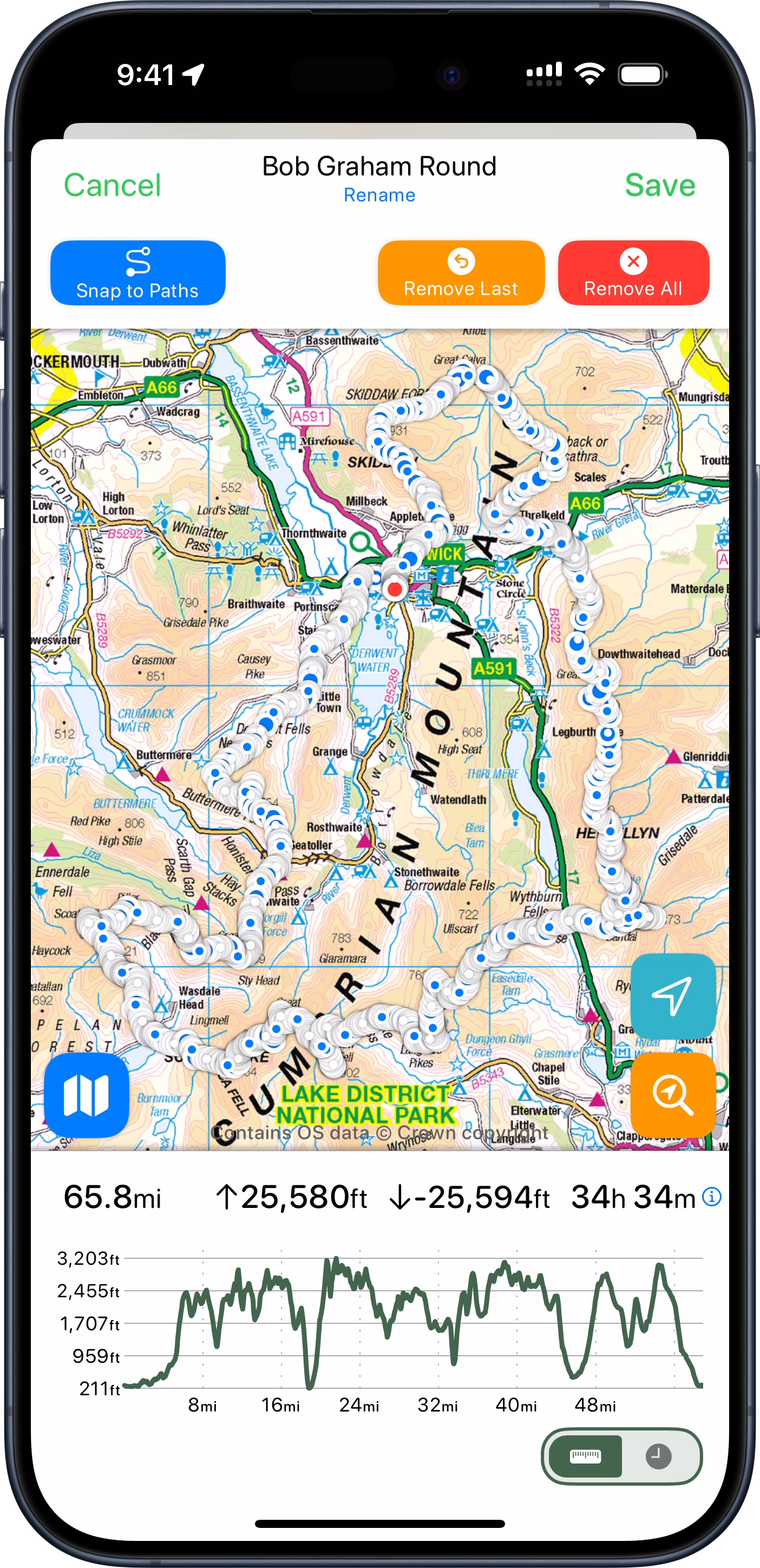
The most famous of which is the Bob Graham Round. This is a roughly 66 mile route which visits 42 high fell tops in a wide reaching loop of most of the Lake District, involving around 26,000 feet of elevation gain and loss.
There are some fell runners which attempt (and remarkably complete!) the entire round in 24 hours. That didn’t appeal to me (nor the health of my knees), but I thought I might try completing it in 42 hours instead.
42 peaks in 42 hours at 42 years old. I liked the sound of that, and so a project was born.
I now had a reason to get up each morning to exercise. A reason to manage my diet and a goal to work towards both physically and logistically.
The Plan
So I began planning towards my Round. Timing wise it looked good for me to plan to come up to The Lakes for my kids school holiday at the end of May (right after my 42nd birthday). I’d come up here for a week and plan to attempt my round on the best two days of weather.
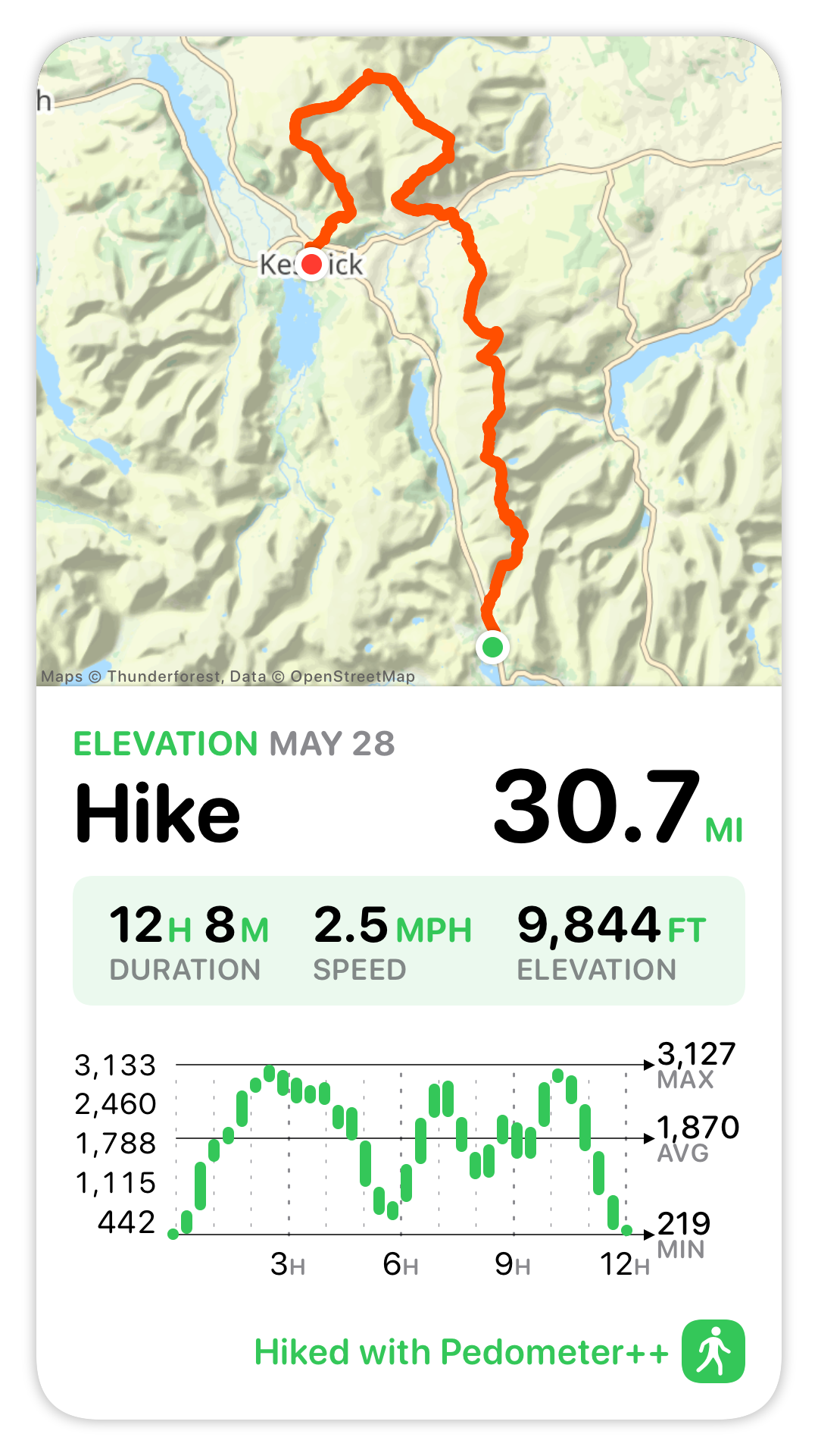
My plan was to complete the first 35 miles of the round on Day One. Starting at dawn and hiking until dusk, then having a brief rest and then heading out at dawn again on Day Two to complete the final 31 miles.
One of the essential rules I have for this kind of expedition is that I avoid any and all unnecessary risk so I didn’t want to travel in the dark. Especially since I am doing this attempt solo/self-supported it isn’t wise to be out in the wilderness by myself after dark. Thankfully the Lakes is pretty far north (54° 36’ N), so in mid-summer the days are very long. I’d have around 18 hours of usable light to work with each day.
I also began to learn and explore the world of ultra trail running. While I would only need to maintain a pace of roughly 2.0 mi/hour for the 18 hours of daylight to complete each of my legs, the terrain I’d need to cover is rough and rocky in sections so I‘d have to run whenever I could to offset these slower sections.
I‘ve been a runner my whole life but never over terrain and in the mountains. I had to learn about the different way you need to pack your gear, fuel yourself and techniques for maintaining your footing on uneven ground.
This was all very fun to me. I love learning new things, indeed that is a huge reason I undertook this challenge. In addition to the physical conditioning it required, it also provided a new venue for me to learn and explore. Something which at 42, I am very aware that if I don’t regularly stretch my mind it will become much less limber.
The Attempt
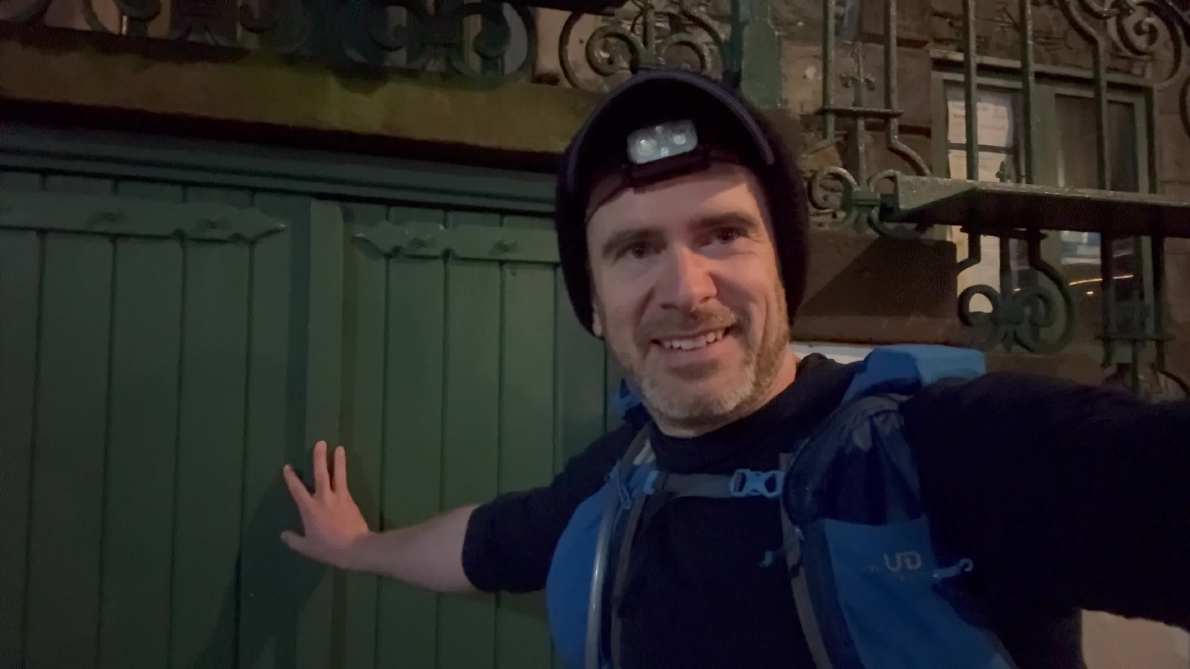
So this brings me to Tuesday, May 27 at the lower door of the Moot Hall in Keswick (the traditional start of the Round), at 3:30am.
There was a bit of comedy in the weather surrounding this expedition. For most of April and May England has been experiencing the sunniest and driest Spring on record. With long periods of fair, dry weather across the entire country. Indeed, I’d had to start making contingency plans for dealing with a lack of water along the route, as high mountain streams were likely all dry. It turned out, however, that those plans were not needed as the day I arrived in the Lakes the drought was broken and the rain arrived.
Rather than the full days of sunshine the last several weeks had seen, I instead needed to find the best 42 hour period I could and hope for the best. The forecast for the day when I started was to be beautiful for most of the day until late-afternoon when a storm would arrive. The nature of my Day One route was that hopefully by then I would have gotten past all the highest peaks for the day and be low enough that I’d be able to weather the storm without much fuss. I am no stranger to rain in the Lakes.
The first part of the day went largely as expected. I reached the first of my 42 fell tops after a steady initial climb.
From there things went better than I could have hoped for the next several peaks. I was in a good flow and actually was a full hour ahead of schedule. My training and planning seemed to have been successful and I was able to move quickly and efficiently over the route. Owing to my very early start I had the mountains completely to myself and was thoroughly enjoying my adventure.
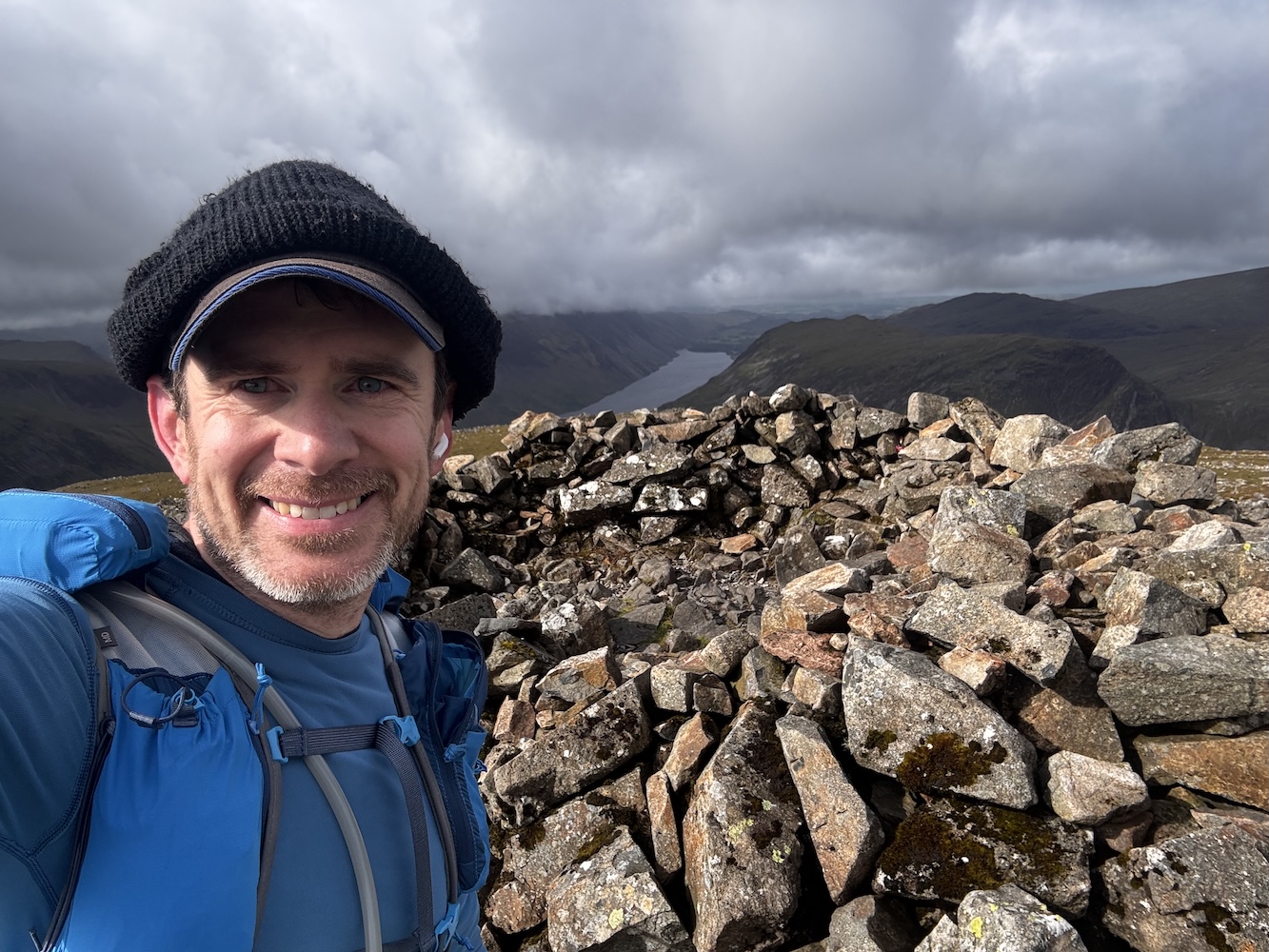
That is until just after I reached the top of my eleventh peak (Red Pike).
Here things took a rapid and undesirable turn. The storm which had been forecast to arrive mid-afternoon blew in from the Irish Sea, and with a strength and vigor beyond which was expected. Things quickly went from high clouds and gentle breezes to drenching rain, dense fog, and buffeting winds.
My wife has always been very supportive of my heading out on solo adventures in the wilderness. She knows how much I value this time and how helpful it is to my mental and physical health. But we have two rules which I must steadfastly follow:
- She must always know exactly where I am.
- I must always make wise choices and avoid any unnecessary risks.
I’ve spent a lot of time in the wilderness, in all manner of weather and conditions, I know when things are fine and when they are definitively “not fine”. I was well equipped for bad weather with high strength rain gear, multiple thermal layers and a warm puffy jacket. But I also was about to reach my final “bailing point” before I headed up into the Scafell ridge where I’d reach the highest point of my Round (and indeed the highest point in all of England).
I put on all of my storm gear and proceeded on for a few miles but it very quickly became clear that it was not wise for me to continue. Something I often say is that the key to staying safe in the wilderness is to be very conscious about what assumptions you are making. I was warm and safe in that moment but I was also at the limit of what the gear I had brought could support. If things got much worse, or if I had a minor accident and needed to slow down or stop for a rest, I would be in real trouble. The early and aggressive turn in the weather had consumed all of my safety margin.
So it was in that moment that I made the very disappointing, but correct, decision to bail off the mountain ridge I was on and drop down into the nearest valley as quickly as possible. While I was extremely disappointed that I wouldn’t be able to complete the route I had planned, reassuringly it wasn’t a difficult decision. I was 100% confident it was the correct thing to do, that it was the only safe path forward.
I dropped down off the ridge and made for the nearest car park and called my wife to come and pick me up. As I descended out of the howling wind I felt warmer and warmer, and as I looked up into the mountains, still wreathed in fast moving clouds, I became more confident in my choice.
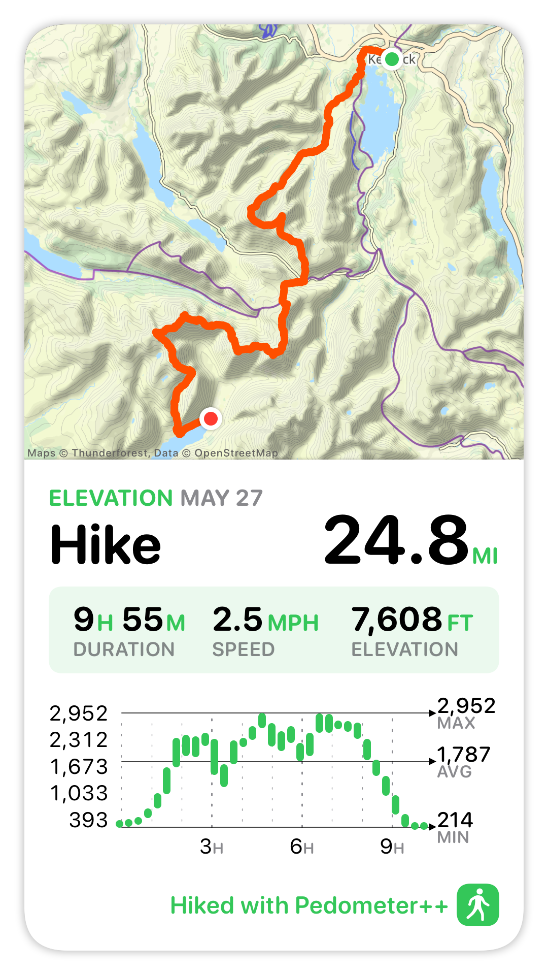
So Day One ended up being just shy of 25 miles, with 7,600ft of elevation gain. Not quite what I’d planned but still a big day out.
The Essential Nature of Adventure
A number of friends and family were following along my adventure (in realtime via a custom website I had created). After it was clear I wasn’t going to complete my planned hike for Day One they reached out with sympathy and encouragement. Which was lovely to receive but strangely I found it wasn’t too much needed. There was certainly a bit of disappointment, but what I found was a certain peace too. What I kept coming back to was that in order to have a true “Adventure”, there has to be a high degree of likelihood that you won’t complete it as planned. If the outcome is all but a foregone conclusion when you begin, then you aren’t exploring, you aren’t finding the edges of your abilities.
That uncertainty is a big part of why I wanted to attempt this Round. Sometimes we get to choose the challenges in our life, but often we don‘t. There have been countless times in my life when brutal, unforeseen circumstances have borne down on me. I’ve gotten through those with the help and support of loved ones, but also to some degree by cultivating the skill of perseverance.
When life isn’t bearing down on me, if I choose challenges which stretch me I will become more comfortable with difficulty. So when the external pressures do arrive they are a little bit less overwhelming.
In this case the essential uncertainty of a wilderness adventure helped to build my resilience, and so I am less disappointed.
Persistence
Next I had to answer the question of what to do the following day. I clearly wasn’t going to be able to complete the Round in 42 hours as originally planned, so should I continue along? I decided to push on as planned. So I got up very early the next morning and headed out for Day Two of the planned adventure.
This would be a roughly 31 mile section with about 10,000ft of elevation gain. It covered my favorite part of the route and included long beautifully runnable sections way up in the mountains (the Dodds section if you‘re familiar with it). I decided to head out with a renewed sense of fun. I no longer had the self imposed “pressure” of trying to hit my goal, it was now just about enjoying the fitness I had built to get here and having a lovely big day out.
I went through the 31 miles of that day with a big smile on my face. I was out in my favorite place, doing my favorite activity and was feeling healthy, fit and safe.
The weather wasn’t perfect, but it was the kind of mix I was fully prepared for, so didn’t cause much trouble.
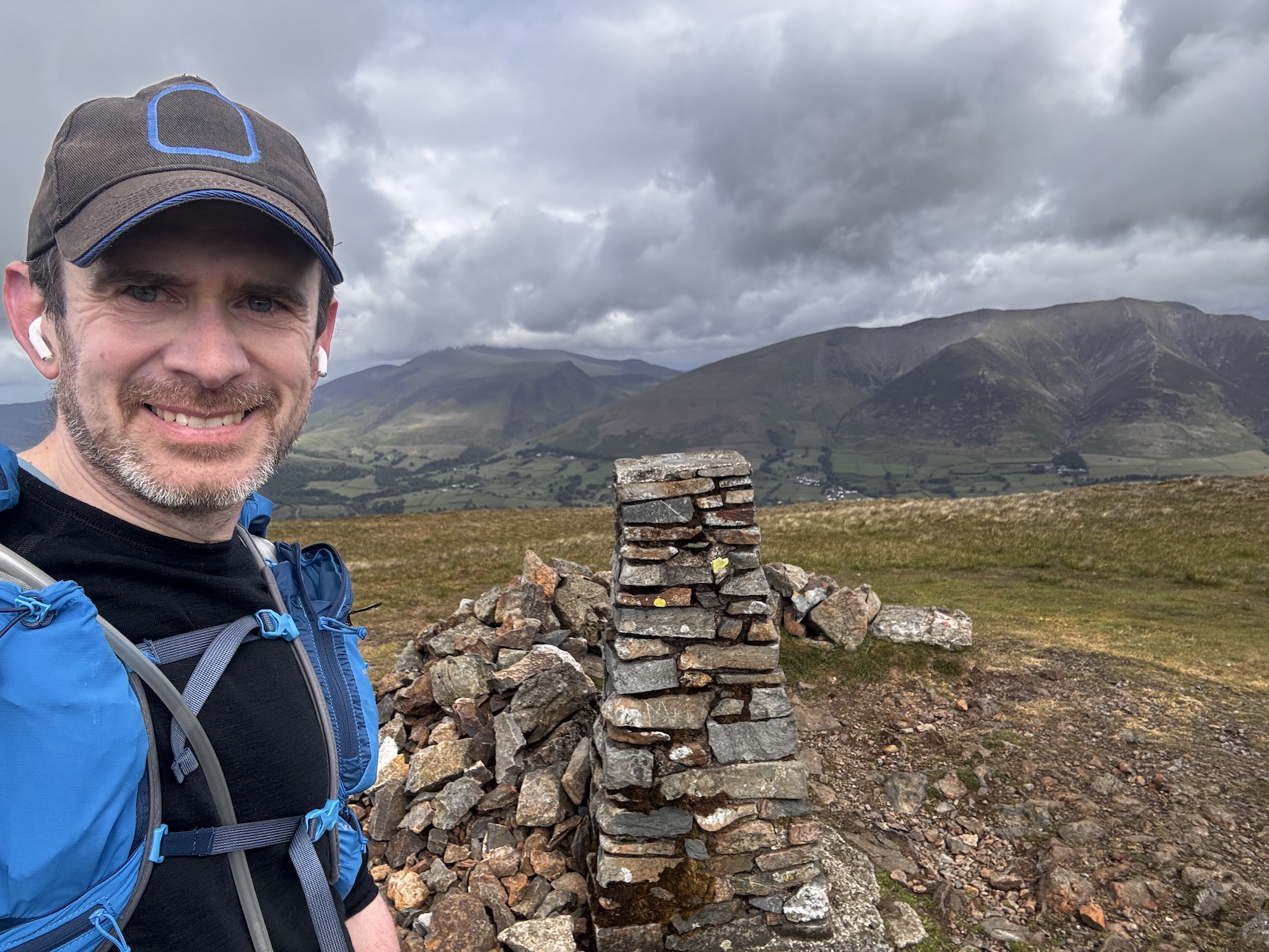
After eleven hours of steady work I summited the final fell of the route (Skiddaw). While not the specific accomplishment I had been planning towards, it was nevertheless a wonderful moment to crest the final hill and see the whole Lakes ahead of me. From that vantage point I could see nearly the entire route laid out before me. It was wild to see how far off in the distance several of the mountains I had been walking on hours before now seemed.
Now there was just the matter of getting down off this final mountain ridge and making my way back to where I had begun.
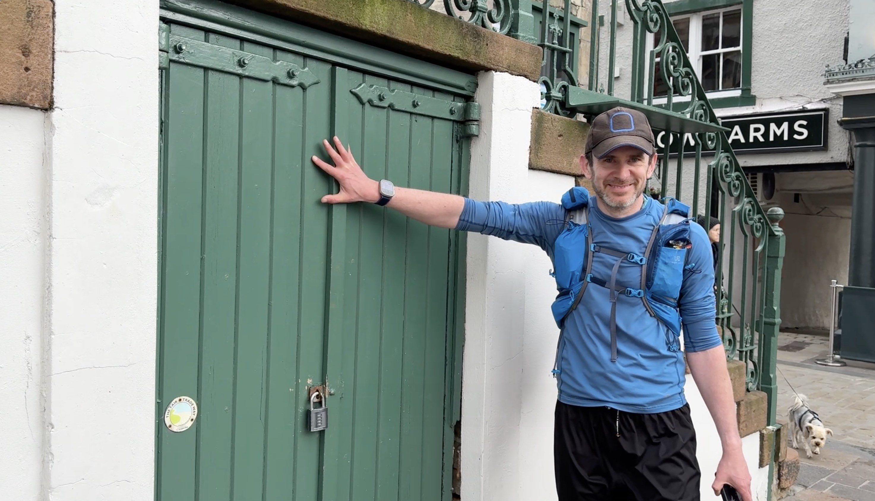
I touched the door at the Keswick Moot Hall at 7:20pm, 38 hours after I had set out initially. The route between those two points was not as planned, but still took me to wonderful places both physically and personally.
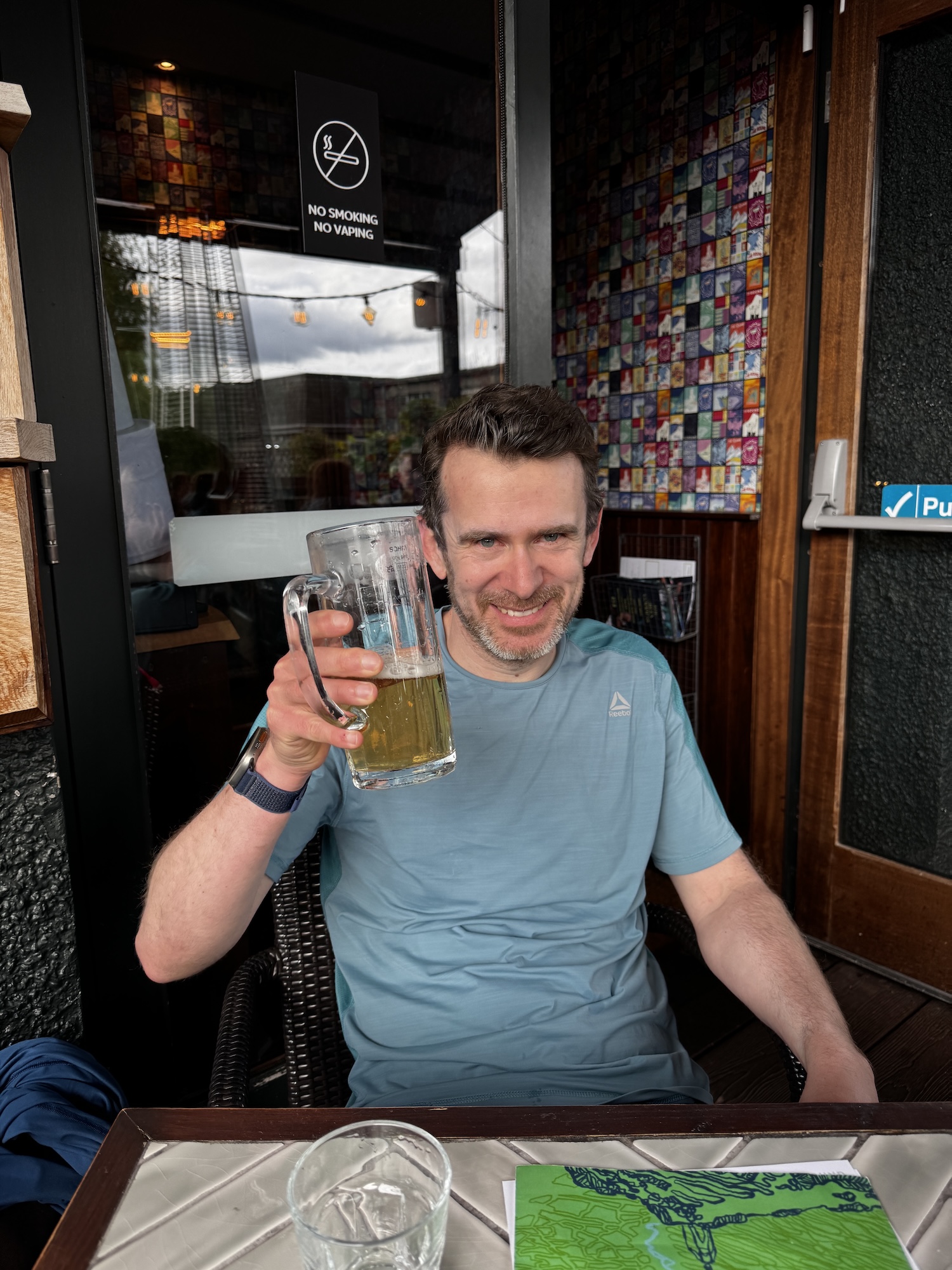
Reaching the end, there was really only one thing to be done. Sit down at the aptly named “The Round” pub next door and enjoy a lovely meal with my family.
The final stats for the trip where:
- 55.5 miles (89.3 km)
- 17,452 feet of elevation gain and loss (5,319 m)
- 22h 3min of moving time (avg 2.52 mph, 4.1 kph), 38h 10 min total.
Technology
Now I couldn’t finish a trip report like this without discussing the various bits of technology which supported and help me along this adventure. I built a number of features specially to help me on this outing, which will now serve as the basis for major updates I expect to roll out in my apps over the next coming months.
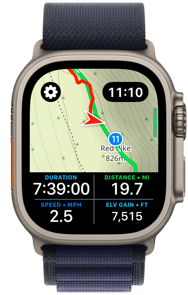
Expedition mode for Pedometer++
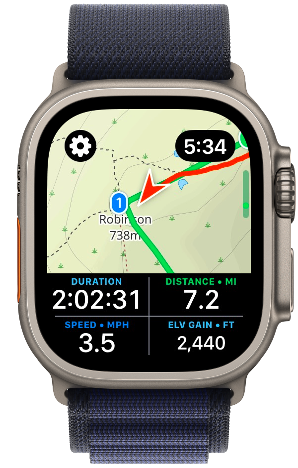
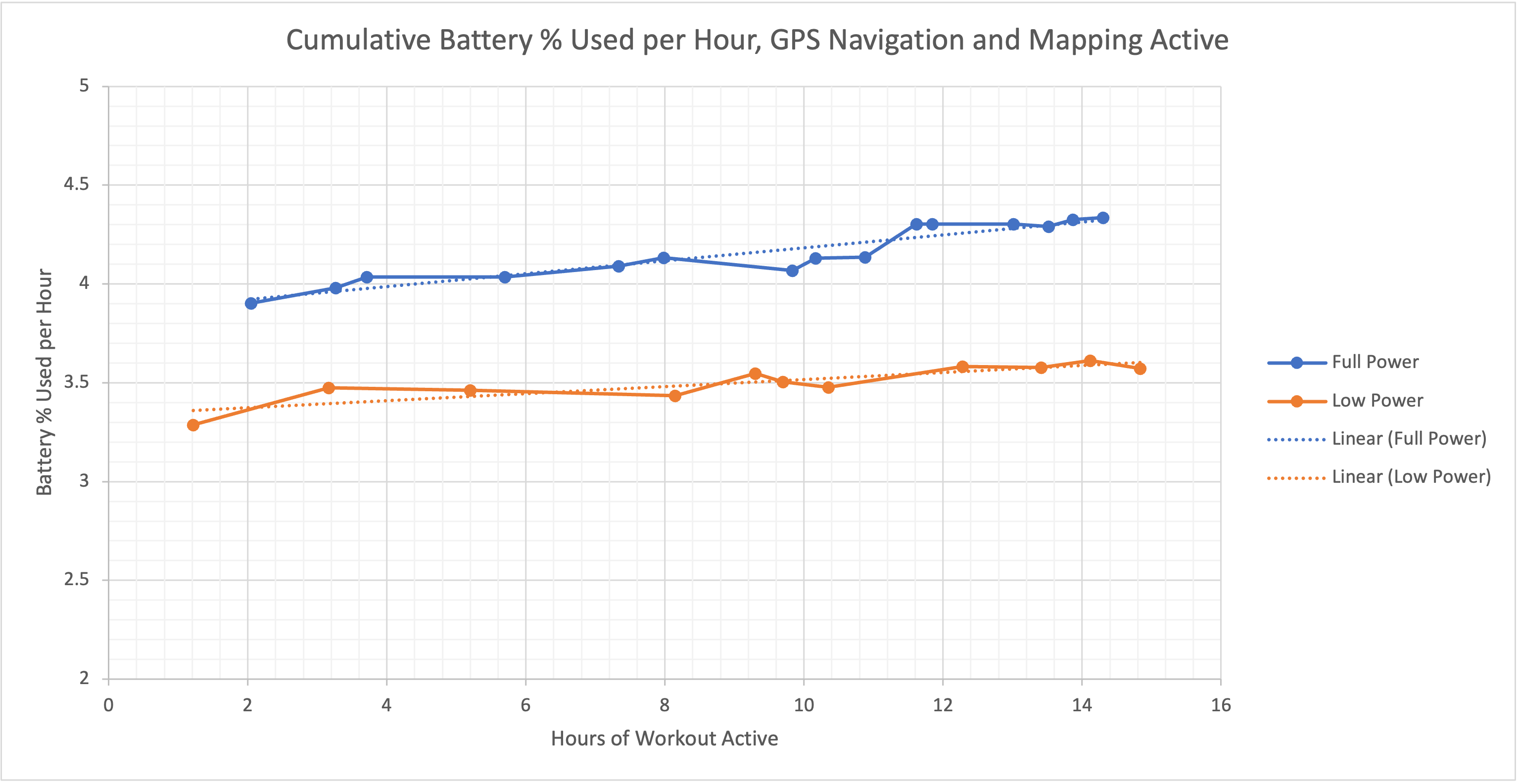
While I could have tracked and navigated this adventure using my app Pedometer++. I was concerned that if Day One had extended out to the full 17 hours that my schedule predicted that the battery life in my 18 month old Apple Watch Ultra 2 wouldn’t have. So I set out to build a custom variant of Pedometer++ which was optimized solely for battery life.
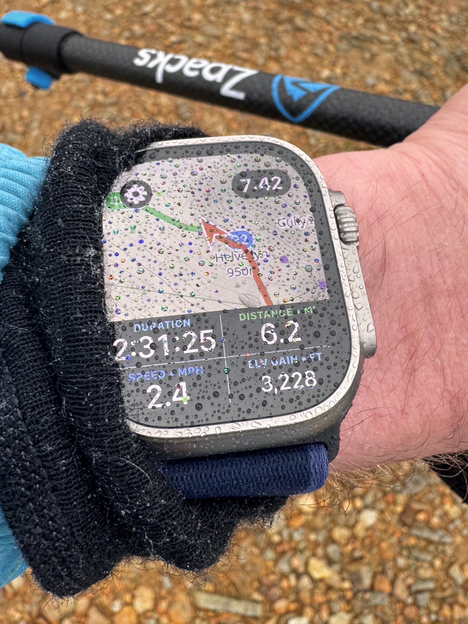
I learned a tremendous amount about how to extend the battery life of an Apple Watch app from this experience. I was eventually able to get the battery consumption on my 18 month old watch down to around 3.5% per hour, which would extrapolate out to around a 28 hour max adventure duration. That is with full-time on wrist navigation and guidance.
I also made a few other speciality improvements to the app, for example, increasing the size of the time shown in the top right corner to make it more legible and building a pre-caching system to fully download the route‘s maps to my watch before setting out to further avoid any power intensive operations while walking.
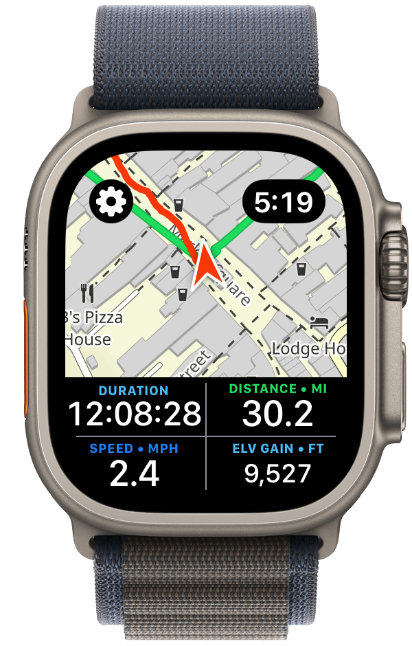
Many of these improvements will now filter back into Pedometer++ itself. The new dual map/statistics view is especially something I’ve found to be excellent for the kind of quick checks I was regularly doing.
Estimate
Because this was a time-based expedition, having an accurate prediction for how long various segments would take me was of incredible help. Pedometer++ already has a basic form of time estimation based on the Naismith Rule, but I needed something a bit more robust.
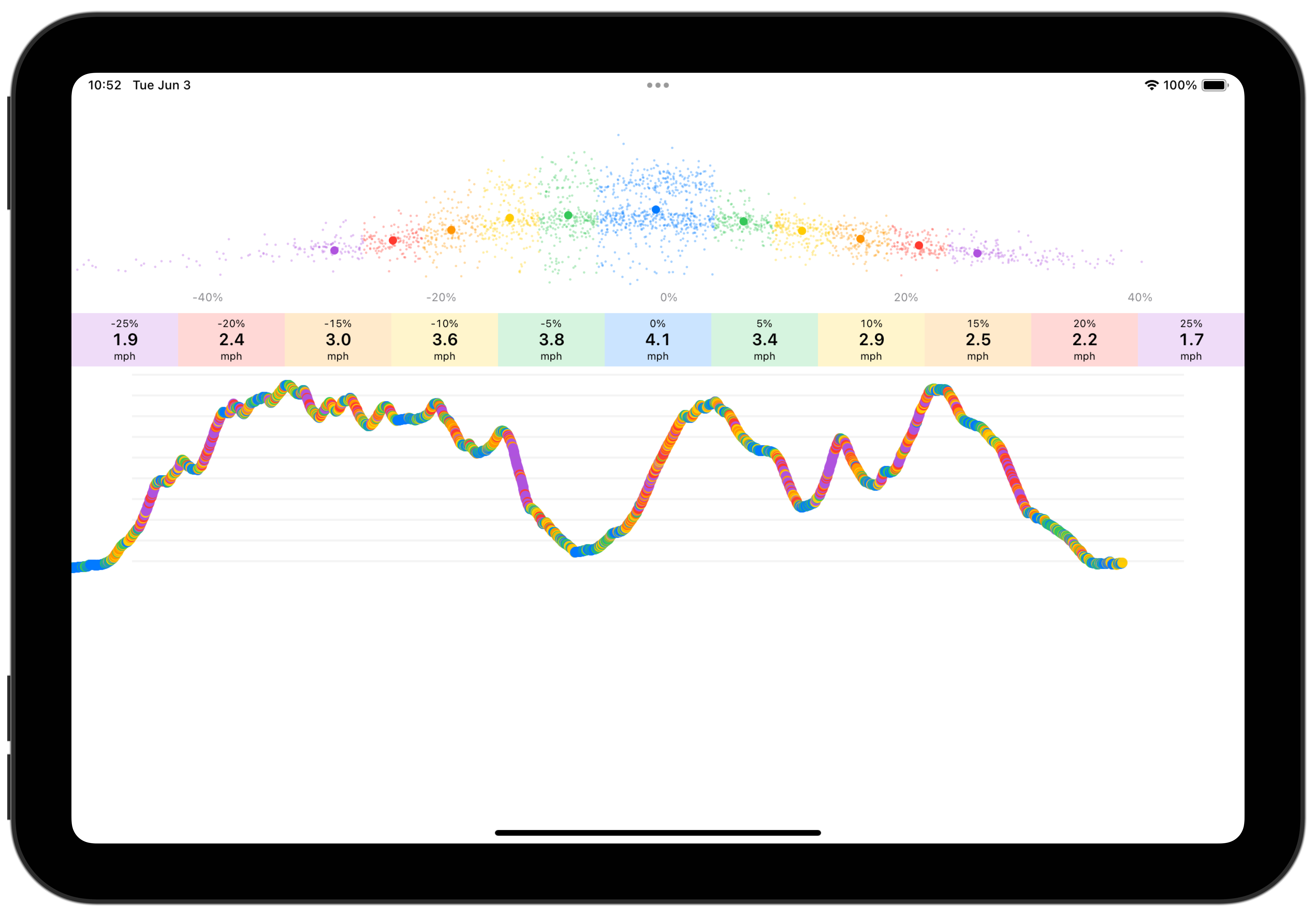
So I built a tool which analyzes past workouts to build a personalized speed profile for me. This segments the workout based on elevation gradient and determines your typical speed for that kind of terrain. Once this model was built I could then take the GPX route file of my planned trip and apply the speed estimates to it to build a prediction of my time for each segment.
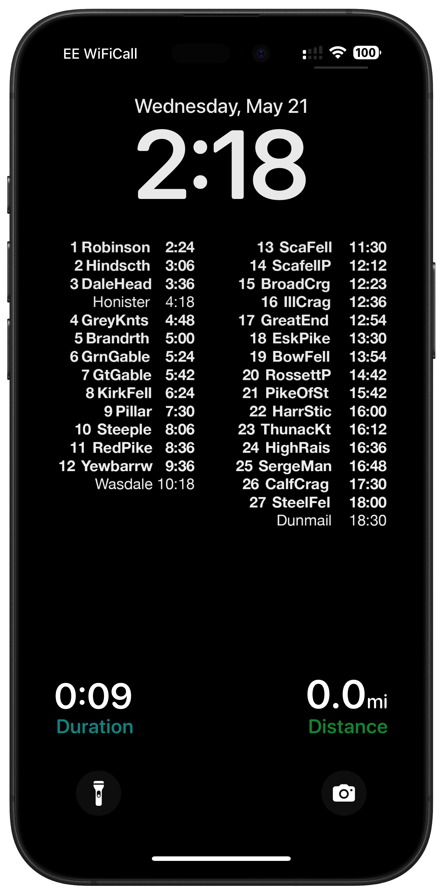
In practice this estimate proved extremely accurate for me. I took the output of this and made a super simple Lock Screen wallpaper for my iPhone which showed my predicted time arriving at different points along the route, aligned so that I could see the Pedometer++ live activity below showing my current stats. So every time I pulled out my iPhone I could check-in about whether I was on track or not.
VO2 max
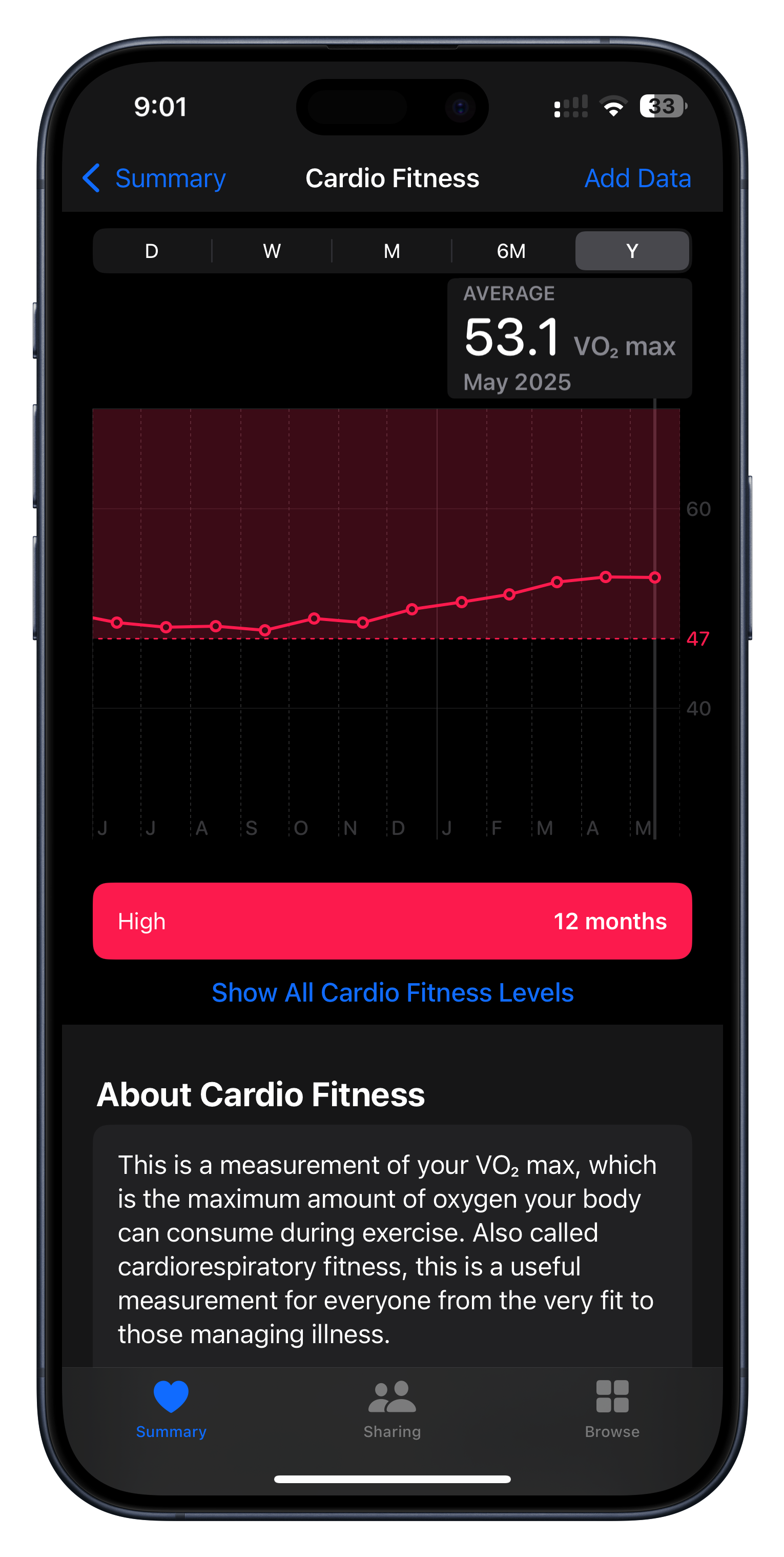
I didn’t build this but I nevertheless found it incredibly motivating during my training. The Apple Watch can generate a predicted VO2 max value whenever you do an outdoor walk or run. I have no idea about the clinical accuracy of the number it generates but I have found that it is incredibly good at measuring my relative fitness.
You can clearly see in the graph above how my fitness was slowly diminishing towards the end of last year and then how once I set the goal of my Bob Graham Round it started to gradually rise until it peaked right before I started my attempt.
So much of training is about putting in repetitions hoping that you’ll see improvement, but that progress is so often impossible to perceive in the short term. The VO2 number is something tangible and encouraging to keep me going when I feel like I’m putting in the work, but not yet seeing the result.
Peak Weather
I recently came across the incredibly helpful Peak Weather app by Piotr Knapczyk.
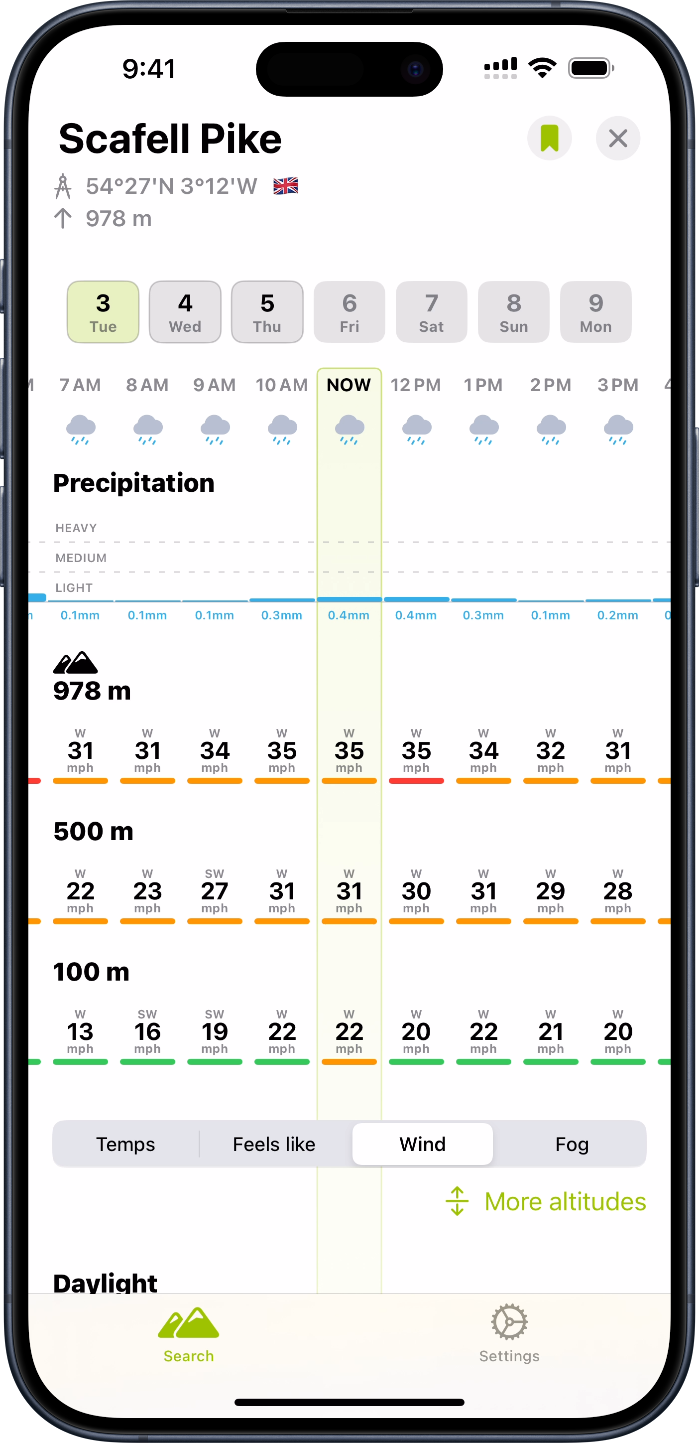
This is a weather app with a hiking oriented twist which I found super helpful in my planning. Rather than just showing the forecast at a particular location, it gives elevation based forecasts as well. So it gives you a sense of what to expect at different parts along the climb of a summit.
While I never was able to find 42 hours of good weather in my trip, this tool was very helpful in identifying the best 42 hours I possibly could.
Beacon
I wanted to give my family and friends a way to track my progress along the attempt (and also give my wife additional peace of mind with knowing my current position for safety purposes). I used a personal tracking beacon for this purpose which reports back my location to a central service every few minutes. The backend system for that service was not something which is particularly feature rich so I built a custom tracking website which pulled my data from their backend API.
This allowed me to overlay my location not just with a map, but also an annotated route map showing my progress along the 42 peaks. Thus giving folks a sense of how far I was along and how much more I had to do.
![]()
This was one of my first times doing some proper “vibe coding”. I’m not all that up to date with Javascript development so I worked with an AI to build the site. The process went very well and I was generally impressed with how much you can do with a little bit of know how and a lot of AI help.
-
In the Lake District, mountain peaks are referred to as “fells”, from the old Norse word fjall. ↩